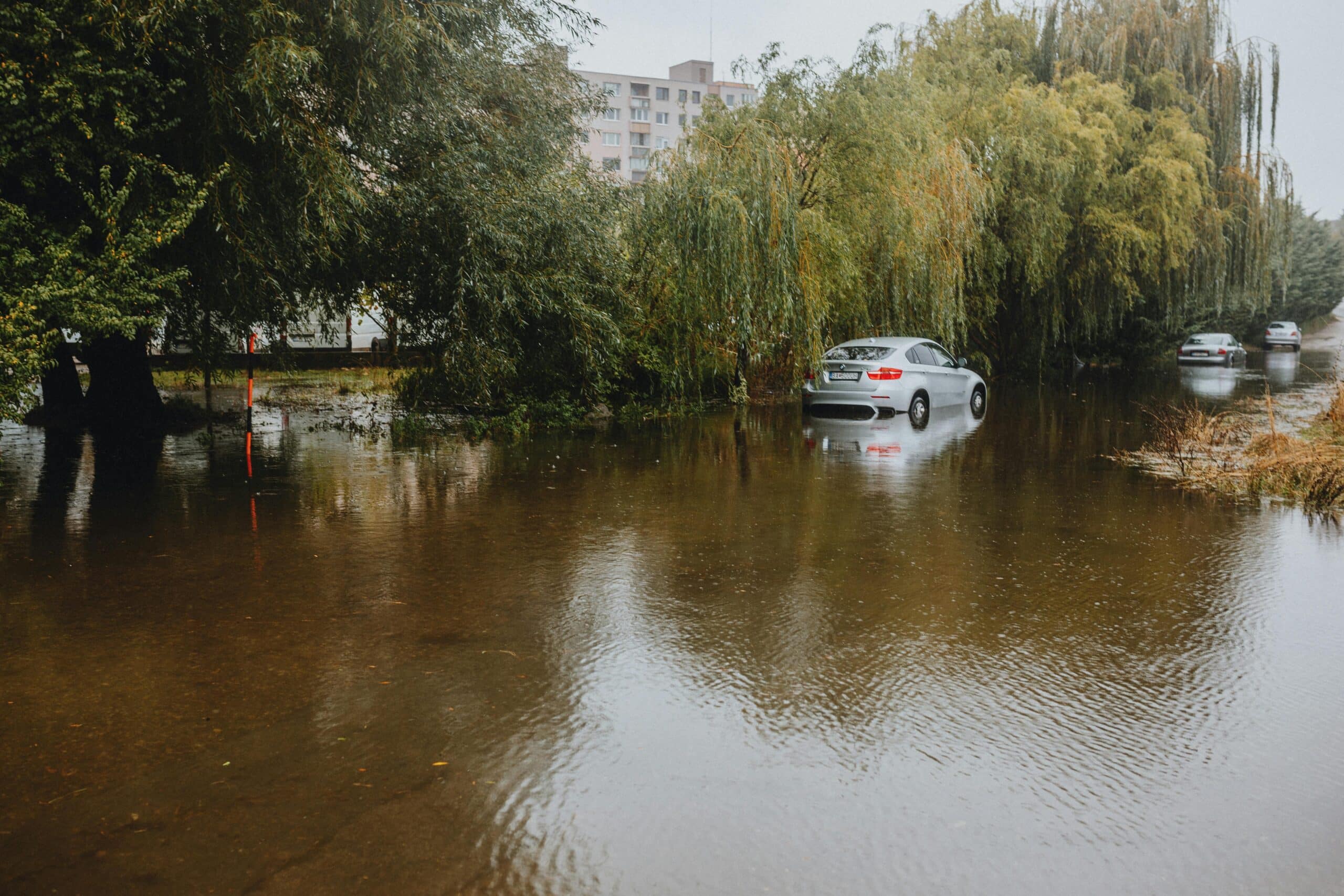
Heavy rainfall and flooding are measurably increasing across the United States—driven by climate change, surface sealing, and the loss of natural floodplains. The Clausius-Clapeyron equation explains the physical foundation: for every degree Fahrenheit of temperature rise, the atmosphere can hold approximately 4% more water vapor, leading to more intense precipitation events. Between 1990 and 2024, over 4,300 flood events were recorded worldwide—an increase of nearly 100 events per year. In the United States alone, Hurricane Harvey (2017) caused insured losses of approximately $30 billion, while the 2021 Ida flooding killed at least 89 people and caused over $95 billion in damage.
Table of Contents
Key Findings from This Article
- Climate change intensifies heavy precipitation in the U.S. by up to 7% per degree Fahrenheit of warming
- Surface sealing and channelization multiply natural flood impacts by a factor of 2 to 5
- FEMA flood maps and technical protection systems significantly reduce operational risks
- Standards-compliant flood prevention protects against liability under the Clean Water Act and NFPA codes
Fundamentals: What Are Heavy Rainfall and Flooding?
Heavy rainfall and flooding are related but distinct phenomena. Heavy rainfall refers to intense precipitation events where large volumes of water fall in a short period, potentially causing localized flooding. Flooding occurs when rivers overflow their banks or when surface water cannot drain quickly enough. Both phenomena are increasing in frequency and intensity—with direct consequences for industrial facilities, municipalities, and critical infrastructure.
Heavy Rainfall Definitions and Thresholds
The National Weather Service (NWS) defines heavy rainfall using specific intensity thresholds. NOAA’s Storm Prediction Center issues flood watches and warnings based on rainfall rates and accumulated totals.
| Intensity Level | Rainfall Rate | Duration |
|---|---|---|
| Moderate Rain | 0.10 – 0.30 in/hour | Sustained |
| Heavy Rain | > 0.30 in/hour | 1-3 hours |
| Extreme Event | > 2 inches/hour or > 6 inches/6 hours | Flash flood conditions |
These precipitation events are classified by their statistical return period. A 100-year flood event means that this rainfall amount statistically occurs once every 100 years—though this does not preclude multiple occurrences in short succession. NOAA’s precipitation frequency analysis shows that short-duration, high-intensity rainfall events have increased across most U.S. regions over the past century.
Geographically, the Gulf Coast, Atlantic seaboard, and Pacific Northwest are particularly affected. According to NOAA’s National Centers for Environmental Information, extreme one-day precipitation events are now twice as frequent in the contiguous United States compared to a century ago—a direct result of altered atmospheric conditions driven by climate change.
Flood Types and Formation Mechanisms
The distinction between riverine flooding and flash floods is critical for risk assessment:
- Riverine Flooding — along the Mississippi, Missouri, or Ohio Rivers; develops over days from prolonged rainfall or snowmelt, allowing warning time
- Flash Floods — occur suddenly when convective storms drop localized extreme rainfall; common in mountainous terrain with rapid runoff, erosion, and debris flow
- Urban Flooding — in developed areas, rainfall overwhelms stormwater systems, causing backups into buildings and basements
- Coastal Flooding — storm surge from hurricanes combined with heavy rainfall; affects Gulf and Atlantic coastal facilities
The Clean Water Act (CWA) and NFPA 1600 Standard on Continuity, Emergency, and Crisis Management define legal requirements for facility flood protection and stormwater management. Industrial facilities face specific obligations for flood preparedness under OSHA’s Emergency Action Plans (29 CFR 1910.38) and EPA’s Spill Prevention, Control, and Countermeasure (SPCC) rules.
Climate Change as the Main Driver of Increasing Flood Risks

While weather describes short-term fluctuations, climate represents long-term trends observed over decades. Global warming leads to more energy and more water vapor in the atmosphere—with direct consequences for the intensity and frequency of heavy rainfall and flooding. Climate change increases weather extremes because a warmer atmosphere can store more moisture.
Physical Foundations: The Clausius-Clapeyron Relationship
The Clausius-Clapeyron equation describes the relationship between temperature and the atmosphere’s water vapor capacity. For every degree Fahrenheit of temperature increase, the atmosphere can hold approximately 4% more water vapor (7% per degree Celsius)—this precipitates as intensified rainfall under suitable weather conditions. With a global average temperature increase of 2.2°F (1.2°C) since pre-industrial times, the atmosphere already contains significantly more moisture.
Researchers at NOAA and the National Center for Atmospheric Research have demonstrated that convective precipitation events like thunderstorms and flash floods are increasing disproportionately—in some cases by up to 8-10% per degree Fahrenheit in the Southeast and Gulf regions. This amplification exceeds the theoretical 4% threshold because additional factors such as altered weather patterns and increased evaporation come into play.
Jet Stream Weakening Effect
Due to enhanced Arctic warming, the temperature difference between the poles and the equator decreases, which can weaken the jet stream. Weather systems then remain stationary for longer—both high-pressure and low-pressure systems persist, intensifying both heat waves and prolonged heavy rain periods that cause flooding.
Regional Climate Projections for the United States
NOAA’s National Climate Assessment projects significant increases in extreme precipitation through 2100. Particularly vulnerable regions include:
- The Northeast and Mid-Atlantic — already experiencing 55% more extreme precipitation events compared to 1958
- The Gulf Coast and Southeast — combinations of tropical systems, sea-level rise, and intense rainfall
- Urban centers with high surface sealing (Houston, Miami, New Orleans, New York City)
- River valleys along the Mississippi, Missouri, and their tributaries
- The Pacific Northwest — atmospheric rivers causing extreme winter rainfall
Seasonal shifts are already evident: winters are becoming wetter in many regions, while summer precipitation is more unevenly distributed—with longer dry periods interspersed with more violent individual events. The Fourth National Climate Assessment projects that the frequency of climate-driven flooding events could increase by 25-50% by mid-century.
Statistical Evidence of the Increase
Attribution science provides clear evidence of human influence on extreme weather. A study on Hurricane Harvey (2017) found that climate change made the storm’s extreme rainfall 3 times more likely and increased rainfall totals by approximately 15%. Harvey dropped over 60 inches of rain in parts of Southeast Texas within four days—the greatest rainfall total from any U.S. tropical cyclone on record.
Insurance industry databases document the trend: According to NOAA’s Billion-Dollar Weather and Climate Disasters database, flooding and severe storm events cost the U.S. an average of $20 billion per year over the past decade, compared to $6 billion per year in the 1980s (inflation-adjusted). The 2023-2024 period saw record-breaking precipitation in California and the Northeast, contributing to over $50 billion in combined flood damage.
Human Amplification Factors of Flood Hazards

Surface sealing, river channelization, and the loss of natural floodplains amplify the impacts of heavy rainfall and flooding by a factor of 2 to 5. The combination of extreme weather events driven by climate change and altered land use leads to faster runoff and more devastating flood events. Even moderate rainfall now causes greater damage than in the past.
Surface Sealing and Runoff
In the United States, approximately 43,000 square miles of land are covered by impervious surfaces—an area larger than Ohio. The runoff coefficient indicates what portion of precipitation flows over the surface rather than infiltrating:
| Surface Type | Runoff Coefficient | Infiltration |
|---|---|---|
| Asphalt/Concrete | 0.85–0.95 | 5–15% |
| Paver Blocks with Gaps | 0.50–0.70 | 30–50% |
| Gravel/Aggregate | 0.30–0.50 | 50–70% |
| Natural Soil with Vegetation | 0.10–0.30 | 70–90% |
For industrial sites and facilities, this means: every square foot of sealed surface increases the local flood risk. Flood protection barriers like automatic flood barriers for 24/7 facility protection can protect buildings from encroaching surface water when the site’s infiltration capacity is exceeded.
River Engineering and Channelization
Approximately 70-80% of natural floodplains in the continental United States have been lost through levee construction, channelization, and development. These floodplain areas originally served as natural flood buffers. On the Mississippi River, channelization and levee construction have increased flood stage heights by 10-15 feet compared to historical levels for the same discharge volumes—the river flows faster and higher, reducing warning time for downstream communities and facilities.
- River straightening — shortens flow paths and accelerates flood waves significantly
- Levee systems — prevent natural overflow into floodplain areas
- Channelization — concentrates water volumes in confined spaces
- Wetland drainage — eliminates natural retention areas
The Clean Water Act (Section 404) regulates wetland impacts and requires mitigation. Facilities in FEMA Special Flood Hazard Areas face mandatory flood insurance requirements and construction standards under the National Flood Insurance Program (NFIP).
Landscape Changes Across the Watershed
Beyond direct watercourse interventions, agricultural practices and drainage modifications alter hydrological conditions on a large scale. Drained wetlands can no longer store water; soil compaction from heavy machinery reduces infiltration rates; tile drainage systems rapidly channel precipitation into streams.
Intensive agriculture reduces organic soil content and thus water storage capacity. These changes are often irreversible and amplify the effect of heavy rainfall and flooding on downstream facilities and infrastructure.
Impacts of Rainfall and Flooding on Society and Economy
Health and Social Consequences of Flooding
Heavy rainfall and flooding pose significant dangers to people in affected regions—not only to property but also to health and social fabric. When floods strike residential areas, people lose their homes, livelihoods, and access to critical infrastructure such as electricity, clean water, and medical care. The climate crisis exacerbates these risks as extreme weather becomes more frequent and intense.
Health risks after flooding include waterborne diseases from contaminated water and mold growth in damp buildings. Mental health impacts—anxiety disorders, depression, post-traumatic stress disorder—are common after flood disasters. Elderly people, children, and those with pre-existing conditions are particularly vulnerable.
Social consequences manifest in the destruction of communities and the need to reorganize—as demonstrated by coordinated recovery efforts after Hurricane Ida, the 2021 Tennessee floods, and the 2023 California atmospheric river events.
Economic Damages and Challenges for Businesses
The economic consequences of heavy rainfall and flooding are enormous and affect businesses across all sectors. Production outages, damaged machinery, destroyed inventory, and interrupted supply chains are typical outcomes. Particularly affected are facilities in flood-prone regions and businesses with critical infrastructure such as energy, transportation, or telecommunications.
Case in point: Hurricane Harvey caused an estimated $125 billion in total economic losses, with widespread industrial facility damage across the Houston petrochemical corridor. The 2025 Washington State floods demonstrated how climate change creates new challenges for facility safety.
Investments in modern flood protection systems, emergency plans, and operational adaptation are becoming increasingly important. At the same time, insurer requirements and regulatory standards are rising. Companies that invest early in climate resilience secure their competitiveness—with industrial flood protection systems and comprehensive facility hardening measures.
Heavy Rainfall and Flooding: Environmental and Ecological Consequences
Heavy rainfall and flooding affect not only people and the economy but also have serious consequences for the environment and biodiversity. Floods destroy natural habitats such as wetlands, riparian forests, and coastal ecosystems. Many animal and plant species lose their habitat, which can lead to a decline in biodiversity.
The climate crisis intensifies this development as extreme weather events become more frequent and intense. Ecosystems are particularly sensitive to repeated flooding, which disrupts soil structure, nutrient cycles, and the balance between species. In some cases, invasive species benefit while native species are displaced.
To limit negative impacts, targeted measures are needed to protect and restore natural floodplains. Preserving and renaturalizing wetlands, promoting sustainable land use, and developing climate-resilient ecosystems are essential to strengthen nature’s resistance to the consequences of climate change.
Common Protection Gaps and Solutions Against Heavy Rainfall and Flooding

Most facilities and municipalities have significant gaps in flood preparedness—from missing risk assessments to inadequate technical protection measures to incomplete emergency plans. Further information is provided by lessons from major flood events.
Inadequate Risk Assessment
Many companies do not know their actual flood risk, despite the availability of FEMA Flood Insurance Rate Maps (FIRMs) and state flood hazard assessments. FEMA’s National Flood Hazard Layer provides flood zone designations, base flood elevations, and floodway boundaries for every address in the United States.
FEMA Map Review
Check your facility’s flood zone designation and base flood elevation
Site Vulnerability
Conduct vulnerability assessment for critical operational areas
Flow Path Analysis
Identify surface water flow paths and low points on your site
Concrete solutions for your risk assessment:
- Review FEMA Flood Insurance Rate Maps for your location
- Conduct a site-specific vulnerability assessment for critical operations
- Identify flow paths and low-lying areas on the facility grounds
- Evaluate stormwater system capacity and potential backflow situations
- Update hazard analysis at least every five years or after site modifications
- Consider how to determine your facility’s flood risk using professional assessment tools
Inadequate Technical Protection Measures
Technical flood protection systems fall into permanent and deployable solutions. Permanent systems such as backflow preventers, retention basins, and fixed barriers provide continuous protection. Deployable systems can be installed when flood warnings are issued.
For facilities at risk from surface water, automatic flood barriers like the Spillbarrier automatic containment system are ideal—they function without power and require minimal maintenance. For comprehensive protection strategies, see modern protection barrier innovations.
How Does an Automatic Barrier Work?
- Liquid reaches threshold — rising water contacts the barrier base
- Float mechanism activates — buoyancy-driven deployment without power
- Barrier seals automatically — creates watertight seal across doorway or opening
No electricity. No manual intervention. No failure in power outages.
Additional technical measures—complementing water-activated flood barriers:
- Separate stormwater and sanitary sewer systems
- Backflow preventers on main drainage lines
- Bioswales and retention ponds for infiltration
- Emergency drainage with adequate capacity
- Flood barriers for doors and garage openings to protect typical weak points
Missing Emergency Planning
Business continuity planning under NFPA 1600 and ISO 22301 considers flood scenarios and defines clear action procedures. Early warning systems from NOAA and local sensor networks enable timely responses—provided alarm chains are defined and tested.
- Defined responsibilities and backup personnel
- Alarm chains with 24/7 reachability
- Evacuation plans for vulnerable areas
- Securing hazardous materials per EPA SPCC rules
- Documentation of critical equipment and processes
- Regular drills and updates to reflect changed risk conditions
Conclusion and Action Recommendations
Heavy rainfall and flooding are demonstrably increasing across the United States—driven by climate change, which brings more water vapor into the atmosphere, and amplified by human interventions in landscapes and waterways. Economic damages are rising in parallel, as Hurricane Harvey, Ida, and the 2023 California atmospheric rivers demonstrate. Facilities that act now not only reduce damage risks but also fulfill their duty of care under the Clean Water Act, SPCC regulations, and NFPA codes.
Immediate Actions
- Review your facility location on FEMA Flood Insurance Rate Maps
- Install backflow preventers in vulnerable areas
- Secure hazardous materials per EPA SPCC requirements
- Define flood response responsibilities and contact chains
Medium-Term Strategies
- Create site-specific vulnerability assessment
- Integrate flood scenarios into business continuity planning
- Evaluate technical protection systems like automatic barriers
- Reduce impervious surfaces, create infiltration opportunities
Combining preventive measures with technical flood protection not only reduces damage risks but also improves insurance terms and fulfills legal duty of care under the Clean Water Act and SPCC regulations. Case studies on flood damage and the use of automatic Spillbarriers demonstrate the cost savings after just one prevented damage event.
Protect Your Facility from Heavy Rainfall and Flooding
Spillbarrier’s automatic flood containment systems provide 24/7 protection without power requirements. Engineered in Germany, trusted worldwide.
FAQ: Frequently Asked Questions About Heavy Rainfall and Flooding
Why are heavy rainfall and flooding increasing in the United States?
Heavy rainfall and flooding are increasing for two main reasons: Climate change leads to more intense precipitation—for every degree Fahrenheit of warming, the atmosphere can hold approximately 4% more water vapor. Simultaneously, surface sealing and the loss of natural floodplains amplify the impacts. Attribution studies show that the probability of extreme flood events has increased by a factor of 1.2 to 9 due to anthropogenic climate change.
What is the difference between heavy rainfall and flooding?
Heavy rainfall refers to intense, short-duration precipitation events—according to NWS definitions, typically exceeding 0.30 inches per hour. Flooding occurs when rivers overflow their banks or surface water cannot drain quickly enough. Heavy rainfall is often the cause of urban flash floods, while classic riverine flooding develops over days through snowmelt or sustained rain.
Which U.S. regions are most vulnerable to heavy rainfall and flooding?
Particularly vulnerable are the Gulf Coast and Southeast due to tropical systems and sea-level rise, the Northeast and Mid-Atlantic with increased extreme precipitation events (up 55% since 1958), urban centers with high surface sealing (Houston, Miami, New York), and river valleys along the Mississippi and Missouri. FEMA Flood Insurance Rate Maps provide information on local risks. NOAA climate scenarios project up to 50% more heavy precipitation days by 2100 in coastal regions.
How does climate change affect heavy rainfall and flooding?
The Clausius-Clapeyron equation describes the physical relationship: for every degree Fahrenheit of warming, the atmosphere can hold approximately 4% more water vapor (7% per degree Celsius). For convective precipitation in the United States, the amplification is up to 8-10% per degree Fahrenheit in some regions. Additionally, altered jet stream patterns lead to longer persistence of weather systems, extending both heavy rain periods and heat waves.
What legal obligations exist for facilities in flood-prone areas?
The Clean Water Act and EPA’s Spill Prevention, Control, and Countermeasure (SPCC) regulations define duty of care requirements. Facilities in FEMA Special Flood Hazard Areas must comply with National Flood Insurance Program construction standards. OSHA’s Emergency Action Plans (29 CFR 1910.38) require flood preparedness procedures. Violations can result in liability claims and significant penalties.
How can I protect my facility from heavy rainfall and flooding?
Effective protection combines multiple measures: backflow preventers stop sewer backups, infiltration areas reduce surface runoff, and automatic flood barriers secure building openings when water rises. Additionally, hazardous materials should be stored in secondary containment and critical equipment elevated. A site-specific risk assessment identifies required measures. See flood protection best practices for comprehensive guidance.
What does inadequate flood preparedness cost?
Economic consequences can be substantial: Hurricane Harvey (2017) caused $30 billion in insured losses alone, with total economic damage exceeding $125 billion. In addition to insured damage, there are uninsured losses, business interruptions, and reputational impacts. Preventive investments in technical flood protection often pay for themselves after a single prevented damage event and can reduce insurance premiums.
What does surface sealing mean for flood risk?
Impervious surfaces like asphalt or concrete channel 85-95% of precipitation as surface runoff instead of allowing infiltration. In the United States, approximately 43,000 square miles are covered by impervious surfaces. This rapid runoff overwhelms stormwater systems and significantly increases flood risks—even from moderate rainfall that previously caused no damage.
What early warning systems exist for heavy rainfall and flooding in the U.S.?
The National Weather Service provides real-time severe weather warnings through NOAA Weather Radio and the Wireless Emergency Alert system. FEMA’s Integrated Public Alert and Warning System (IPAWS) delivers flood warnings to mobile devices. The U.S. Geological Survey’s National Water Information System provides real-time river gauge data and flood forecasts. Local sensors on facility grounds provide early warnings when alarm chains are predefined and regularly tested.
Spillbarrier Engineering Team
The Spillbarrier Engineering Team consists of industrial safety engineers, technical writers, and spill containment specialists with decades of combined experience in automatic barrier technology. Our focus:
- Developing automatic, energy-free flood and spill containment systems engineered in Germany
- Providing clear, practical guidance on U.S. standards including FEMA, EPA, OSHA, NFPA, and FM Global compliance
- Delivering honest technical information without exaggerated claims
- Sharing real-world case studies from industrial, commercial, and municipal installations
Disclaimer: This article does not replace professional engineering consulting or site-specific flood risk assessment. Consult a qualified civil or environmental engineer, FEMA-certified floodplain manager, or licensed professional for facility-specific guidance. All regulatory references are current as of publication but subject to change.

