Washington State Floods of December 2025: Lessons for Protecting Building Openings
Key takeaways
- Atmospheric rivers between 5 and 19 December 2025 caused record flooding in western Washington; the federal disaster declaration DR-4906-WA covers ten counties.
- The Skagit River near Mount Vernon peaked at 37.73 ft on 12 December 2025, above its previous record of 37.37 ft from 1990 (USGS).
- The Desimone levee on the Green River in Tukwila failed on 15 December 2025; local authorities said flooding was confined to small industrial areas.
- An automatic opening barrier closes without staff or power, but it only protects up to its sealing height and only at the openings where it is installed.
- A site assessment starts with the design water level, then covers every opening, drain and penetration, the structure and night-time operations.
In December 2025 a series of atmospheric rivers brought record flooding to western Washington State. The Skagit River reached the highest level on record at Mount Vernon, a levee on the Green River failed in Tukwila and flooded industrial areas, and the state counted nearly 3,900 damaged homes. This article sets out what is verified about the event and what it teaches owners of industrial and commercial buildings about protecting doors, gates and loading docks, including what an automatic flood barrier can and cannot do.
About this article: it is not a report on an Anhamm installation, and no Spillbarrier was involved in the events described. The figures below come from public sources linked in the text. The product section is a general engineering assessment, not a statement about what would have happened at any particular site.
What happened in the December 2025 Washington floods
The federal major disaster declaration for the event, DR-4906-WA, was approved on 7 April 2026. According to the Washington State Emergency Management Division, it covers severe storms, straight-line winds, flooding, landslides and mudslides between 5 and 19 December 2025 in ten counties: Chelan, Grays Harbor, King, Lewis, Pacific, Pierce, Skagit, Snohomish, Thurston and Whatcom. The governor’s request for that declaration describes a series of atmospheric rivers and winter storms between 5 and 22 December that caused widespread flooding, landslides, high winds and power outages.
| Item | Verified figure | Source |
|---|---|---|
| Rainfall | More than 10 in (250 mm) in 72 hours at several western Washington locations, to the morning of 11 December (preliminary NWS data) | NASA Earth Observatory |
| Skagit River near Mount Vernon (USGS gauge 12200500) | Peak stage 37.73 ft (11.50 m) at 00:15 PST on 12 December 2025. Previous highest stage in the USGS peak record: 37.37 ft (25 November 1990) | USGS, USGS peak record |
| Desimone levee, Green River (Tukwila) | Failed on 15 December 2025; evacuation order sent to about 1,100 homes and businesses in parts of Kent, Renton and Tukwila | Associated Press |
| Evacuations and rescues | More than 100,000 people under evacuation orders; 383 emergency rescues | Office of the Governor |
| Homes | About 3,891 homes damaged, 440 of them destroyed or with major damage | Office of the Governor |
| Deaths | One | Office of the Governor |
Atmospheric rivers on saturated ground
An atmospheric river is a long, narrow corridor of water vapour that can release heavy rain for days when it reaches the coast. NASA Earth Observatory reported that this one began affecting the region around 7 December, that Seattle-Tacoma International Airport set a daily rainfall record of 1.6 in (40 mm) on 10 December, and that floodwater and mudslides closed numerous roads, including the eastbound lanes of I-90 out of western Washington. This is the typical pattern for the region: the Washington Department of Ecology notes that floods in western Washington usually result from prolonged winter rains, and that flooding costs the state more than any other natural hazard. For the physical background, see our guide on how floods form.
Skagit River: a record crest and a floodwall that held
The USGS gauge on the Skagit River near Mount Vernon recorded its highest stage just after midnight on 12 December 2025, about 0.36 ft above the 1990 record. The peak flow, about 133,000 cubic feet per second (roughly 3,770 m³/s), was lower than the 152,000 cfs of November 1990. The record was set by water level, not by flow, which matters for site owners: the level reached at your door depends on channels, levees and the floodplain as well as on how much water the river carries.
The Associated Press reported that the floodwall completed in Mount Vernon in 2018 held and protected the downtown area. In neighbouring Burlington, muddy water overflowed a slough and rushed into homes, reportedly 2 to 3 ft (0.6 to 0.9 m) deep in places, and about 1,000 residents had to evacuate in the middle of the night.
Green River: the Desimone levee breach
On Monday 15 December, after a week of high water, part of the Desimone levee beside the Green River in Tukwila failed. According to the Associated Press, crews had been installing a “seepage blanket” to reduce the risk and were on site when the breach occurred. King County sent an evacuation order to about 1,100 homes and businesses east of the river in parts of Kent, Renton and Tukwila. The National Weather Service flash flood warning initially covered nearly 47,000 people and was reduced within a few hours to an area of about 7,000. Renton and Tukwila said the flooding was confined to small industrial areas, and nobody was injured.
Public sources do not give the water depth reached inside individual buildings, so this article does not estimate it.
What failed and what held: five lessons for building owners
1. A levee reduces the risk; it does not remove it
The Desimone levee was a known concern, and it failed several days after the heaviest rain, during prolonged high water. A site behind a levee should plan for the residual risk: what happens to the building if the levee seeps, is overtopped or breaches?
2. Permanent protection sized for a design level performed
Mount Vernon’s floodwall held at a record river level. Permanent measures designed for a known water level do not depend on people arriving in time, which is the weak point of temporary defences.
3. Water arrives by more than one route
In Burlington the water came from a slough, not straight from the main river. On an industrial site, water can also come up through floor drains and sewers, through cable and pipe penetrations, or through the ground.
4. Warning time can be short, and floods do not wait for office hours
Burlington residents were evacuated in the middle of the night, and the levee breach led to an evacuation order the same day. Sandbags, stop logs and doors that must be closed by hand all need people on site at that moment.
5. Access to the site may be cut
Road closures, including on I-90, show that staff may not be able to reach a site during a regional flood. A plan that depends on a team driving in to install defences should have a fallback.
How water gets into industrial buildings
Most flood damage to commercial buildings starts at a small number of low points. When surveying a building, list every one of them with its threshold height:
- personnel doors and roller shutters at ground level;
- loading docks, dock levellers and ramps, which are often the lowest points of the building;
- ramps to underground car parks, basements and plant rooms;
- floor drains and sewer connections, where water can flow back into the building;
- cable ducts, pipe penetrations, ventilation openings and light wells;
- walls and floor slabs, through seepage and, in deeper water, uplift.
A barrier at a door or gate only deals with that opening. Drains need backflow protection, penetrations need sealing, and pumps are needed for the water that still gets in. Our article on how to determine flood risk explains how to find the mapped hazard for an address.
Hydrostatic load: why the water depth matters
Water pressure increases linearly with depth, by about 9.8 kPa per metre (0.433 psi per foot). At a depth of 0.5 m (about 20 in), the pressure at the base is about 4.9 kPa (0.7 psi) and the horizontal force on each metre of barrier width is about 1.2 kN. At 1 m, the pressure is 9.8 kPa and the force about 4.9 kN per metre. Because the force grows with the square of the depth, doubling the water depth quadruples the load on a barrier, a door frame or a wall. A design water level that is too low is therefore not a small error.
What an automatic opening barrier can and cannot do
An automatic flood barrier such as the Anhamm Water Spillbarrier is set flush into the floor of an opening. Water collecting in its tray makes the barrier float up, and springs then fold it into an upright, tightly closed position. The system is 100% mechanical and needs no electricity or other external energy. The mechanism is explained in more detail in what water-activated flood barriers are.
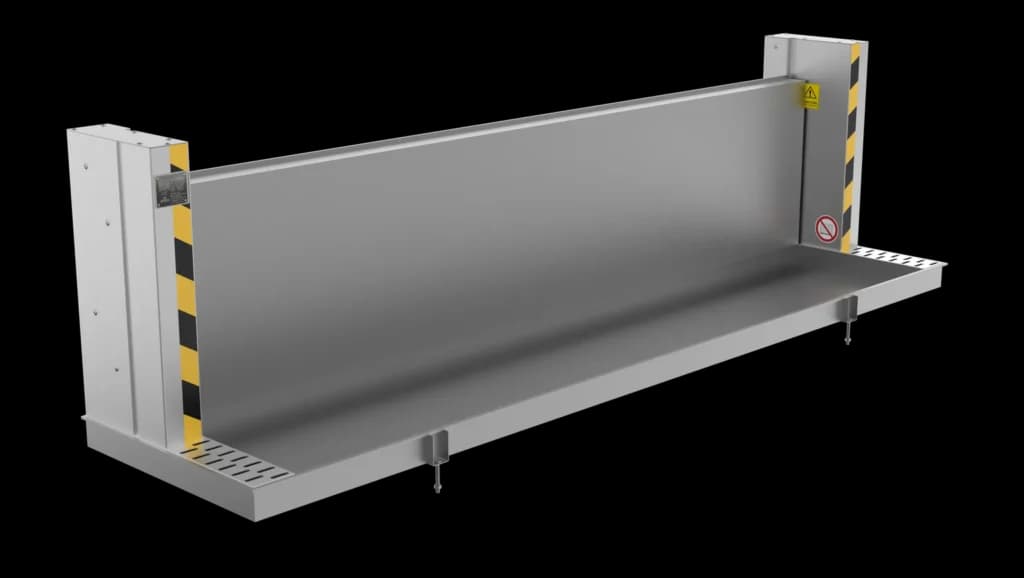
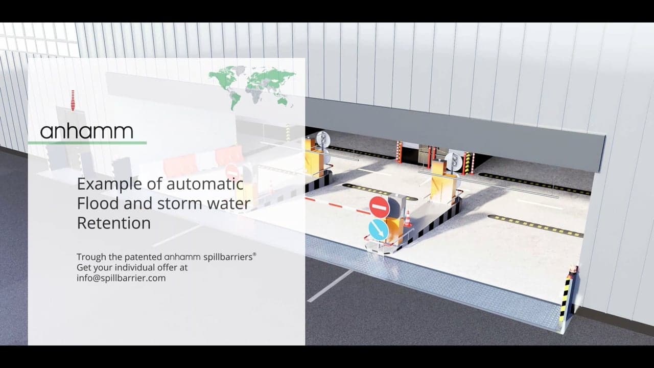
Playing loads the video from Vimeo.
What it can do
- Close without staff, power or warning time. It is activated by the water itself, including at night or when nobody can reach the site.
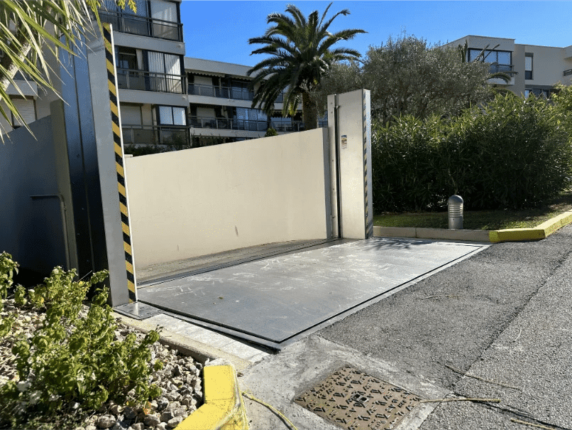
- Stay out of the way the rest of the time. Installed flush with the floor, it lets vehicles pass. Drive-over capability has been tested under RW-TÜV supervision (DIN 1055); the load rating for your traffic is confirmed during project planning.
- Fit the opening. Each barrier is made to measure for the opening width, with sealing heights from 0.30 to 2.40 m.
- Last. It is built from AISI 304 stainless steel with PTFE seals, and its leak-tightness has been tested over at least 72 hours (RW-TÜV).
- Report its status. Optional SmartBarrier notifications and audible or visual signals show when it has been triggered.
What it cannot do
- Hold back water above its sealing height. The height has to come from a site-specific design water level plus a margin.
- Protect other routes. It does nothing for openings where it is not installed, or for water coming through drains, penetrations, walls or the floor slab.
- Replace a levee, a floodwall or an emergency plan. It protects a building opening; it does not reduce the flood.
- Compensate for a weak structure. Walls, frames and slabs next to the barrier must be checked for the hydrostatic load.
- Work without any care. It requires minimal maintenance, but periodic cleaning and inspection are needed to keep it functional.
Leak-tightness has been tested over at least 72 hours. Compare that with how long water could stand at your opening; rivers such as the Skagit stayed high for days in December 2025. Longer durations should be discussed during planning.
Would it have helped in Tukwila or Burlington?
For a specific building, nobody can say without data that is not public: the water level reached at each opening, how long it stayed there, and whether water also entered through drains or walls. In general terms, where the water at an opening stays below a barrier’s sealing height and the rest of the building envelope is tight, an opening barrier keeps that water out. Where the water rises above it, or finds another route, it cannot. That is why a site assessment starts with the water level, not with the product.
How to assess your site
- Find the mapped hazard. Start with the FEMA flood maps for your area; in Washington, the Department of Ecology publishes Risk MAP data and lists regional floodplain contacts, and your county has current local information.
- Look at the gauge history. Check the nearest USGS and NWS river gauges and their record levels, including December 2025, and find out which levees protect your site and what condition they are in.
- Survey every opening and penetration. Record the threshold height of each door, dock, ramp, drain and duct relative to the expected water level.
- Set a design water level and duration. Add a margin to the level, and estimate how long water could stand against the building.
- Check structure and drainage. Have walls, frames and the floor slab checked for the hydrostatic load and uplift, and fit backflow protection and pumps where needed.
- Plan the operations. Decide who does what at 2 a.m., what happens if roads are closed, and which measures depend on people being present.
- Include hazardous materials. Chemicals and oils stored at ground level can be carried away by floodwater. Coordinate flood planning with your spill prevention planning, for example an EPA SPCC plan where one is required, and see our article on flood risk for industrial facilities.
- Talk to your insurer about the measures they expect and how they will assess them.
Protection options for openings compared
| Option | Staff needed when the water comes | Power needed | Main considerations |
|---|---|---|---|
| Sandbags | Yes, many people and hours of work | No | Not watertight; needs stock, labour and disposal afterwards |
| Demountable stop logs or flood panels | Yes, to fit them | No | Needs storage, trained staff and enough warning time |
| Flood doors and gates | Yes to close them, unless motorised | Motorised versions: yes | Must be closed in time; motorised versions need a reliable power supply |
| Automatic water-activated barrier | No | No | Needs a floor recess (civil works) and periodic cleaning and inspection; the sealing height is fixed at the design stage |
Why this matters beyond Washington
The mechanisms seen in December 2025 are not unique to the Pacific Northwest: prolonged rain on saturated ground, levees under load for days, water arriving by side channels, and floods peaking at night. The Ahr valley flood of 2021 in Germany showed several of the same patterns. The questions for a building owner are the same everywhere: how high can the water get at each opening, for how long, and what closes that opening if nobody is there?
Frequently asked questions
What caused the December 2025 Washington floods?
A series of atmospheric rivers and winter storms brought days of heavy rain to western Washington. According to NASA Earth Observatory, several locations received more than 10 inches (250 mm) of rain in 72 hours to the morning of 11 December (preliminary NWS data).
Did the Skagit River set a record in December 2025?
Yes. The USGS gauge near Mount Vernon recorded a peak stage of 37.73 ft at 00:15 PST on 12 December 2025, above the previous highest stage of 37.37 ft from November 1990.
What happened at the Desimone levee?
Part of the Desimone levee on the Green River in Tukwila failed on 15 December 2025. An evacuation order went to about 1,100 homes and businesses in parts of Kent, Renton and Tukwila; local authorities said the flooding was confined to small industrial areas (AP).
Can an automatic flood barrier protect a building if a levee fails?
It can keep water out of the opening where it is installed, as long as the water stays below its sealing height and the rest of the building envelope is tight. It does not reduce the flood itself, and it does not protect drains, penetrations or other openings.
How high should a flood barrier at a building opening be?
It should be based on a site-specific design water level, taken from flood maps, gauge records and local history, plus a margin. Anhamm Water Spillbarriers are made to measure, with sealing heights from 0.30 to 2.40 m.
Sources
- Washington State Emergency Management Division: Disaster assistance, DR-4906-WA and December 2025 atmospheric river flooding
- Office of Governor Bob Ferguson (21 January 2026): Request for a federal major disaster declaration
- U.S. Geological Survey: Skagit River near Mount Vernon, gauge 12200500 and annual peak record
- NASA Earth Observatory (12 December 2025): Pacific Moisture Drenches the U.S. Northwest
- Associated Press via OPB (12 December 2025): Washington flooding forces an entire city to temporarily evacuate
- Associated Press via KNKX (15 December 2025): Crews shore up Green River levee breach
- Washington Department of Ecology: Floods and floodplain planning
- U.S. EPA: Overview of the SPCC rule (40 CFR part 112)
Have your openings assessed
If your building sits in a floodplain, behind a levee or at a low point in the drainage network, start with the openings that would cause the most damage if water got in: electrical rooms, production areas, stores and hazardous materials areas. Contact the Anhamm team to discuss your openings, the design water level and whether an automatic barrier is the right measure for them.
Updated October 2026: event figures checked against USGS, the Washington State Emergency Management Division, the Office of the Governor and Associated Press reporting; figures that could not be verified have been removed.